Part of my route dev series, a pre cursor to epic rides.
A second dip into the same lower foothills / inner area of the Gifford Pincot close to Carson WA. This time refining a few roads and trying some different approaches to the climbs and connecting roads.
- 55Miles, 5,000ft
- Gravel Bike or Hardtail Mtb
- 70% Gravel / off road
- Gearing: Preferably easier than a 34/27 low gearing.
The same basic area as route 0.2b (shown here) , still incorporates the amazing NF4220 (which is a solid fav), but this time the paths to and from NF4220 were a little different. In broad strokes taking NF43 gravel up there and NF 54 down. NF54 is paved, narrow windy and fast, 8 miles of speedy descending, really fun.
Riding from Carson gave us a mild road warm up, I like this type of start, allows you to spin your legs and also gain some context instead of just jumping straight into a gnarballs gravel climb. We started at Backwoods brewery and had a chill 7 miles up to where the action kicked off.


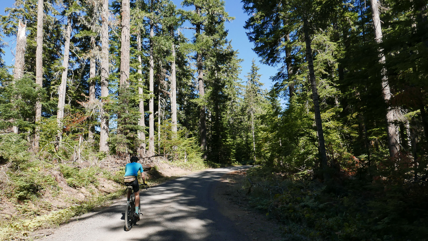
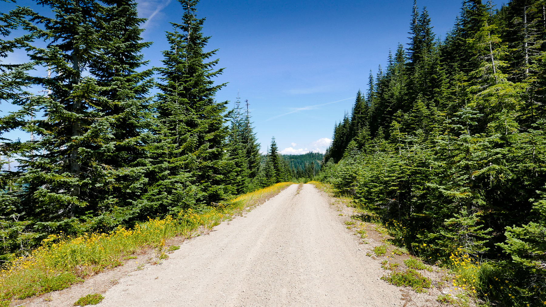
Above: The mellow section of NF43 Up. It gets rowdy about a mile from the end.
Last time in the Gifford we took NF-412 up, 412 was overgrown with a lot of down trees, but it was nice riding, mainly in the shade and but a lot of traipsing over fallen branches as the path is not maintained or cleared. Both 41 and 43 go up through Gifford’s experimental forest. This time we used NF43 which was a much different kettle of fish, NF 43 is a maintained gravel road, I should say maintained in parts.
It started really mellow, in fact maybe deceptively mellow… then right near the end, the pitch got rowdy. Sometimes hitting a 17% grade on very loose rock gravel stuff. You can bust through it on road gearing with a 27tooth cassette, but it was right at the limit. MTB gearing or a larger range cassette would be the ticket.

No Biggie, just some fresh 357 Magnum casings, choice of fishermen everywhere.

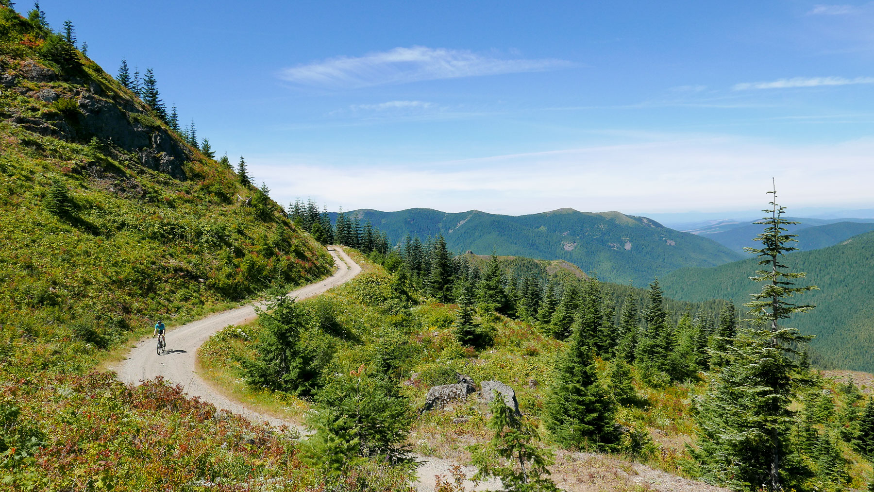
Above: The start of NF 4220 before amazeballs breakout.
As 4220 rounds the corner the view breaks out to open exposure on one side looking towards Yacolt into the valleys from about 4,00ft. Open landscape and rock face combined with twisty roads make for perfect pictures and that sense of vast wilderness.
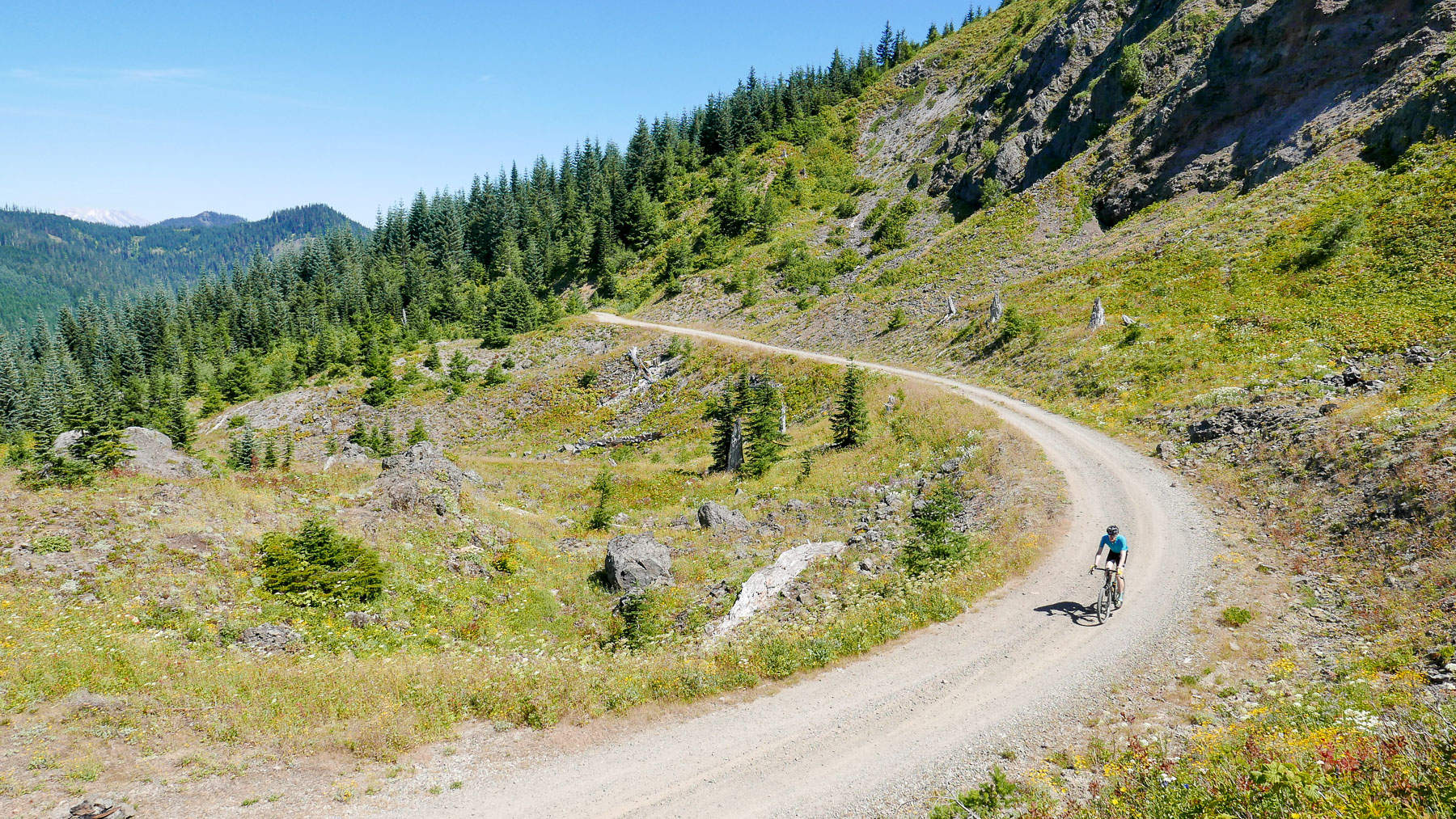

Above: Intersection of NF4220 and NF42. Also known as Cougar rock. Not too shabby, one might say.
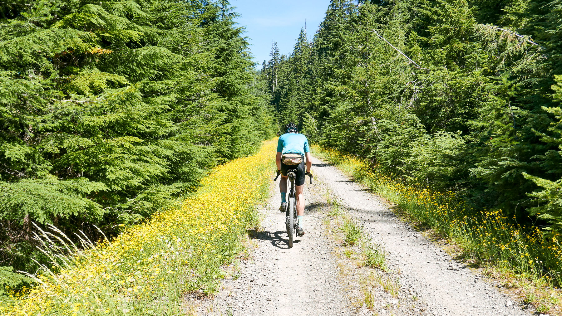
NF34 was also pretty stellar because this time of the year flanked with wildflowers. As you round the corner, what’s not shown here are the views of both St. Helens and Mt. Hood.

Above: In the background the path up to Twin Rocks, worth a go, but we didn’t.

Above: Sections of buttery pea gravel after all your hard work climbing.


Above: Streams lower down available for water refills. This was Wind River at mile 40 but there are earlier spots like East Fork Trout Creek.
Final word
The decision between using NF412/NF41 Hemlock vs NF43 is a very fine one. Even with the tree scrambling NF412/41 Hemlock is a more interesting route. Has more diversity and a few more views. Both are tough nuts to ride but in different ways. 412 has a lot more dismounting, climbing over and going around stuff – 43, that last mile is killer and not in a good way, the lower stuff can be a tad mundane, it’s a boxed-in gravel climb. Maybe Ron will chime in on this subject.
Discover more from Buckyrides
Subscribe to get the latest posts sent to your email.

Leave a Reply